Address
:
[go:
up one dir
,
main page
]
Include Form
Remove Scripts
Accept Cookies
Show Images
Show Referer
Rotate13
Base64
Strip Meta
Strip Title
Session Cookies
Map in 1800
Skip to content
Explore
When autocomplete results are available use up and down arrows to review and enter to select. Touch device users, explore by touch or with swipe gestures.
Log in
Sign up
Explore
Map in 1800
Discover Pinterest’s best ideas and inspiration for Map in 1800. Get inspired and try out new things.
Last updated 5d
Related interests
Ornate Historical Map
Old Historical Map Detail
Us Map 1700s
1770 World Map
World Map 1860
See more
Map in 1800 and more
Explore related boards
Temporal Storytelling
,
99 Pins
·
,
9y
explore maps
,
70 Pins
·
,
2mo
Old info
,
207 Pins
·
,
4y
Cartography
,
16 Pins
·
,
6y
cartography
,
40 Pins
·
,
7y
Historical Map World (1800)
Map Of The World 1800
Map Of The World In 1800
World Map 1800s
World Map 1776
Maps 1800
18th Century Map
Black And White Map 1800s
Historical Map Black And White
Historical Map World (1800)
Historical Map Symbols
Map Symbolism
17th Century Map Design
Cartography Symbols
Hand-drawn Historical Map
17th Century Old Map
18th Century Map Art
18th Century Map Design
Diy Cartography
map symbols – French – 17th-19th century – Making Maps: DIY Cartography
1600s Map
Map Of The 1600s
Maps From The 1600s
Historical Map Europe 1600s
Historical Map Europe 17th Century
17th Century European Routes
Historical Map Europe 16th Century
Ancient Map Of Western Europe
Vintage Map Of Ancient Europe
1644 map of Europe
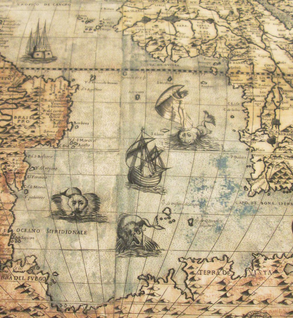
Antique Nautical Map
Decorative Sea Monster Map
Historical Map Collection Inspiration
Home Decor Map Ideas
Vintage Map With Ships And Sea Monsters
Old World Map 1800s
Geography Vintage Nautical Sea Map
Old Maps Of The Sea
Ancient Map With Ships And Illustrations
Antique Nautical Map
Victorian Atlas Map
Printable Digital Antique Globe Image
Western Hemisphere Map Poster
Eastern Hemisphere Map 1800s
Vintage Hemisphere Maps
Old World Map Hemispheres
World Map 1700s
19th Century World Map
Original Antique Double Hemisphere Map
Victorian Atlas Map
Antique Cartography Style
Maps From The 1500s
Vintage Medieval Map
Vintage Compass Map With Dragons
1900s Map
Vintage Medieval Map Art
19th Century Cartography
1850 Map
Here There Be Dragons Map
Antique Cartography Style
Vintage Maps From The 1800s
Historical Map 19th Century
1800s Geography Map
Early 1900s Map
19th Century Atlas Design
19th Century Cartography
19th Century Geography Book
Historical Map 1850-1910
19th Century Geography Chart
The Stunning Early Infographics and Maps of the 1800s
Antique Maps
Antique World Map
Old World Map
Old World Maps
Vintage World Map
18th Century Map Art
18th Century Map
18th Century Geography
Antique Map 19th Century
Antique Maps
Old World Map Design
Downloadable Old World Map
Old World Map Poster Printable
Antique Sepia Maps
Old World Map 1700s
17th Century World Map Printable
Old World Map 1930s
Old World Map 1950s
Old World Map Digital Download
Old World Map Design
Virginia And Florida Map Vintage
Antique Map Artesia
Historical Map Florida Coast
Florida Map Historical
Antique Territorial Map
Historical Florida Cartography
Virginia And Florida Map Antique
Old Maps Of Florida Usa
Historical Florida Coastline Map
Virginia And Florida Map Vintage
Sea Maps
Antique Cartography Style
Vintage Historical Cartography
Antique Cartography Illustration
Ancient Map
Ancient Ocean Map
Antique Map With Ship Illustration
Old Maps Of The Sea
Antique Map / Cartography
Sea Maps
Vintage Historical Detailed World Map
Vintage Ethnographic World Map
South America Map 1950s Printable
Digital Download South America Map
South America Vintage Map
Vintage Map Of Ancient India
Antique Ethnographic World Map
Rare Map Of South America
Map Of South America 1922
Vintage Historical Detailed World Map
Vintage Map Historic Map
Vintage Antique Old Map
Vintage Maritime Map Page
Antique Map 1700s
Antique Pola Map
Antique Map / Cartography
Old Maps Of The Sea
Vintage Historic Antique Map
Old Ocean Map
La Jolla Map Museum
Pretty Maps
Old World Maps Vintage
Antique Map Background Style
Vintage World Map
Old Map Vintage Style
Old World Map
Antique Map Background
Aesthetic Map
Vintage Old Map Poster
Vintage Map of Forgotten Kingdoms
Antique Island Map Illustration
Map Of Ancient Crete
Old Maps Of The Sea
Crete Ancient Map
Old Map Of Adriatic Sea
Antique Island Map
Old Sea Map
Ancient Rare Map Of Crete
Visscher Map Of Crete
Antique Island Map Illustration
Old Map Vintage Style
Vintage Antique World Map
Vintage World Map Texture
Vintage Historical Detailed World Map
Vintage World Map On Parchment
Vintage Map On Old Paper
Vintage Sepia World Map
Vintage Old World Map Background
Old World Map 1700s
Old Map Vintage Style
1880 World Map
World In 1500
World Map With Colonial Empires
World Map With Fictional Empires
European Empire Map 2070
Colorful Empire Map
World Map 1500s
European Empire Map 2050
World Map 1700s
1880 World Map
1800s World Map
1873 Antique World Map Of The World 1800s
Map Of The World 1800s
World Map 1800s
1800s Geography Map
Antique World Atlas Map
Victorian Era World Map Printable
Eastern Hemisphere Map 1800s
Vintage Ore Deposits World Map
1800s World Map
Map Of England And France
Vintage Map Of English Countryside
Old England Map
Historical Map Of England 1400s
Vintage Map Of England And France
9th Century English Map
Medieval France Map Yellow
Old British Maps
Old Map Of The Uk
Map of England and France 1152-1327